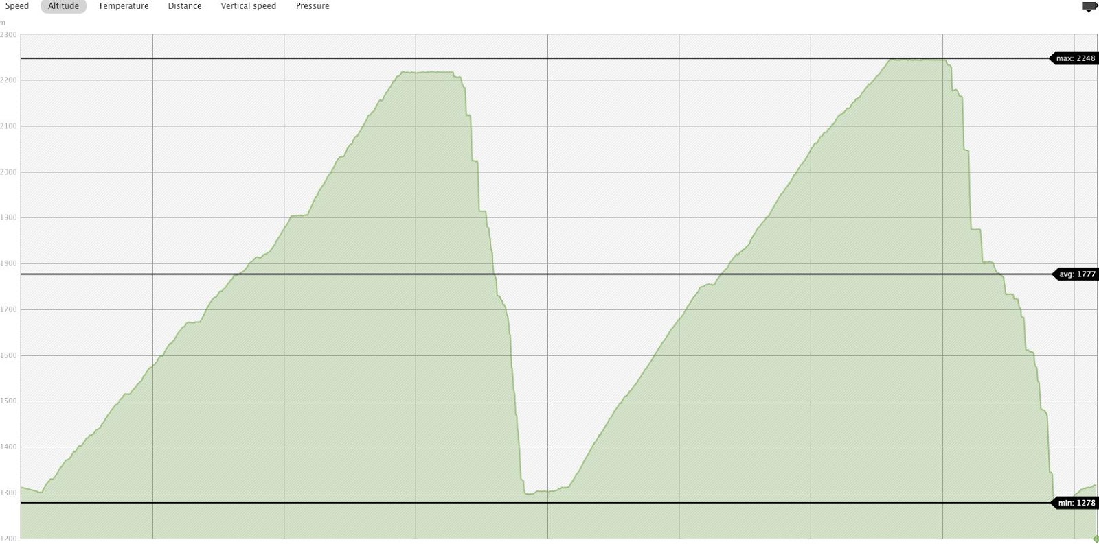
Wednesday 30 January 2013

Spearhooker

Daily Vert: 800m
Total Vert so far: 26,765m

Another half day tour with Steve before work.  Last week we went to Decker so the plan this week was to check out the Phalanx area.  I mostly prefer avoiding the Stairmaster and taking the longer route to Phalanx by skiing the whole way down the Spearhead and then skinning up and around.  This also gives easy access to the hidden bowls in between the Phalanx and Spearhead Glaciers, which may or may not be called Spearhooker, or possibly Secret Bowl....  Perhaps if there is a guide from Whistler heli reading this they can help me out on that one.

Anyway... the snow on the Spearhead was a little wind effected but not too bad.  The 2nd run was similar at first but once we got to around tree line the snow was much much better.  The thing that really makes or breaks this route is the snow quality on the Poop Chutes, but fortunately for us today it was pretty good.

The main drawback of this route is that all the skinning is at the end- and it is a long and flat boring skin, especially if you finish you runs as far to the east as we did.  Next time I go to this area I will stick to the main route down Phalanx, which cuts about 30 mins of flat skinning off the return time.
Steve making turns on the Spearhead

 Steve looks back at our (flat) tracks on the lower section of the Spearhead


 Looking back up at the far skiers left variation of the Warrior Couloirs

 Mt James Turner in the distance

Looking back at Spearhooker/Secret Bowl/Phalhead/Spearlanx.... what ever its called... 

Standard Husume shot from the top of the Poop Chutes.

Tuesday 29 January 2013

Dean's Adieu

Daily Vert: 150m
Total Vert so far: 25,965m

Jess and I planned a quick Corona Bowl lap before I had to go to work, but as the weather came in and Jess was having some boot issues we skied back down Dean's Adieu from near the East Col.  The snow was untracked and nice and soft.

Friday 25 January 2013

Casper Creek

Daily Vert: 1000m
Total Vert so far: 25,815m

Friday Lee invited me to join him an Sharon on exploring what was for them a relatively unknown area, Casper Creek.  At first I wasn't too excited, I figured that Lee has spent so much time in the Duffy, he must have all the high value routes pretty well figured out, and if it was an area he wasn't familiar with then it was going to be a lot of walking and not much skiing.  Fortunately that turned out not to be the case.  Although it is a very long approach into this zone- 7km on the flat, taking approximately 2 hours- There is a wealth of good skiing on Mt Duke, its lower bowls and the surrounding sub peaks.  We treated this trip mostly as a recon mission, skiing as far as the lake at the bottom of the West Bowl of Duke, doing a few short laps and then heading home, but there is definitely more terrain worth coming back for.


Thursday 24 January 2013

Sproat Again.

Daily Vert: 1450m
Total Vert so far: 24,815m

After enjoying Sproat so much on my last visit around Xmas time I decided to go back again right after the first snowfall Whistler has had in 2 weeks.  Despite having to break trail we made pretty similar time up the Rainbow trail, although we took a slightly different variation by continuing along the main trail for an extra few hundred meters before taking the sharp left to head up Sproat.  Although only slightly displaced from the previous route, this route is vastly superior, much less steep with much more space in between each tree, allowing huge elevation gobbling traverses between each switchback.  On the previous trip we had stayed in the open meadows below the west ridge, swung around the big cliff and approached the summit from the east.  Although this was fairly simple I thought that climbing the west ridge directly looked like it might provide a slightly quicker route to the summit.  On that trip Rob had voiced that he thought a long cliff band in the trees would prevent easy access to the West Ridge.  I was determined to find out today.  At first our approach was on the wrong side of the open glades, so we decided to climb out of the glades and then ski back down closer to the ridge.  While climbing up and skinning out of a steep gully we set of a small avalanche, which carried both Benoit and I a few meters down the slope.  The slide was about 10m x 10m and approximately 30cm deep.  It ran about 30m.  After noting the poor stability and adjusting our route accordingly, we skied a short way back down towards the bottom of the Ridge.  The snow was dispassionately heavy and the terrain rather flat.  It quickly became clear that Rob had been correct- the large cliff band above the tree line looks like it disappears in the trees, but in fact it persists, and it took us a good long while to find a spot where we could get above it. And even then it required some annoying boot packing and tree climbing.  Then once on the ridge it was still a long and annoying with lots of micro terrain to work around to get to the summit.  In conclusion... Go around the front... the West Ridge sucks!  Once at the top the visability was pretty bad, but we found the line we wanted to ski, although the snow was pretty heavy and disappointing.  The ski out was fairly uneventful, it's pretty easy from this zone, although we did lose the trail a few times as it hadn't been broken before us.

Benoit after being carried a short way by the class one avalanche on our skin up.


Wednesday 23 January 2013

Golden Boner

Daily Vert: 300m
Total Vert so far: 23,365m

Two of my self imposed rules when embarking on this project were:
1)No touring alone
2)No touring up shitty logging roads just for the sake of it.

I decided to break both of those rules today, but I managed to justify it to myself thusly: It wasn't unsafe to tour this route alone as it is practically inbounds, there is no avalanche danger and the route is travelled often by cats and snow-mobiles. And the reason I was touring for the sake of it was a)it was a good opportunity to explore the access roads behind my house incase I want to ski them at some point and b) I was worried about my stamina being negatively affected by my brief but intense illness last week, so I wanted to make sure I got back in shape.  Nothing much to say about this route, except clearly people with out ski passes sometimes attempt to use it to access Blackcomb (foot prints everywhere) and there are tons of cool looking pillows, although I suspect that they are seldom as soft as they look!


Tuesday 22 January 2013

Decker with Steve

Daily Vert: 500m
Total Vert so far: 23,065m

Steve, who works with me at Ski School and the Spag hasn't been touring much yet this season and he is keen to get involved, so on an overcast day when it hasn't snowed for over 2 weeks, we strolled out to Decker before work.  Pretty uneventful... standard routes up and down... Skied down the 9th Hole.  Snow was horrific. haha.  9th Hole seems way steeper with out pow on it!


Saturday 19 January 2013

Cerise Creek overnighter

Daily Vert: 2150m
Total Vert So far: 22,565m

With plenty of sunshine in the forecast and some consecutive days off, Runar and I hatched a fairly ambitious overnight plan.  The goal was to skin into Keith's Hut, dump our overnight gear, tour around Vantage Peak all day.  The following day the idea was to carry our all our gear to the Joffre-Matier col, summit Joffre, then ski out on the Matier Glacier side and go out to the highway via Joffre Lakes.

There were just a few things that we didn't count on thou.  Firstly, howling, howling winds about 2000m.  Second, horrifically poor snow conditions about tree line.  Third, 9 rowdy nurses also staying at the hut, and finally, a horrendous bout of vomiting at the start of the second day.

Everything started off according to plan.  We left Whistler at about 7.30am, and were on the skintrack/highway to Keith's Hut not long after 9.  To avoid detouring to the cabin we stashed our overnight gear behind a rock at the bottom of the glacier, and attempted to summit Vantage peak from the ridge line between the true peak and the lesser summit.  We were buffeted by extremely strong winds the entire way, and the ridge line is slightly on the sketchy and exposed side.  Gaining Vantage peak from the Matier-Vantage col may well be the better route.

After some sketchy traversing we entered the summit couloir and then skied about 500 vertical meters on extremely disappointing snow.  We were hoping all that wind had blown some nice pow into the north facing bowls, but it was not to be.  It was wind hammered breakable crust.  Boo.

Undeterred we went up for a second lap, this time skiing off the slighter lower sub peak of Vantage.  The smaller and more protected bowl here had slightly better snow, and still good vert, a definite improvement on the first lap.

After that we returned to the foot of the Glacier to collect our gear, and then continued on to the cabin.  There were 3 other guys already there who had stayed the previous night, and after a quick hot snack we headed out for a sunset lap.  We climbed the shoulder above the hut and then skied the bowl on the east side of Joffre.  This was another good run although the snow was a little variable, and if you ski this run you're self be a little care- skiers left is good, skiers right is good, in the centre there are some cliffs and frozen waterfalls.

We reached the approach trail just as it got dark and happily skinned back around to the hut by headlamp.  To our surprise the another group had arrived in our absence- 9 emergency nurses from Vancouver and Squamish with 2 dogs, a cheese fondue and enough peanut butter brownies to feed the third world.

After a sociable dinner and a couple of card games everyone turned in between 9 and 10, and surprisingly for a group of 14 in the hut, there was not a single snorer.

Runar and I had decided to put the summiting of Joffre on hold pending a reassessment of conditions in the morning.  We had skied good snow and bad snow on the first day, all the good snow was below the tree line, all the bad snow above it.  Maybe focusing on the peak wasn't the best idea when we could just take a few more mellow pow runs in the morning.

In the end we didn't need to make that decision.  Although I had been feeling fine all day some unexpended light vomiting before breakfast was followed by some severe vomiting after breakfast.  My ski trip was over.  I lay shivering and sweating in my sleeping bag for a few hours while Runar took a few laps with the ladies, and some of the other nurses were able to hook me up with some hospital strength anti-nausea pills.

Runar returned after bagging an additional 800m, and after saying goodbye to the rest of the hut's occupants we made our way back to the car.

All in all wer achieved considerably less than originally planned, but we still good a few good turns and enjoyed our first hut trip of the season.  Touch wood I only usually get sick once a year, so hopefully now I'm in the clear for the rest of the season!

Runar on the approach

Twin peaks of Matier and Joffre

Matier looking like some Himalayan monsters as it is rocked by high winds

Joffre

Howard and it's far-too-gnar-couloir

Runar skins up the windy ridge

Small couloir that we skied off Vantage Peak

Runar ready to drop in on our second lap

Sunset over Rohr

Both line that we did in the morning off Vantage Peak and Lesser Vantage

Cheques in the Mail looking all pink and orange.

I've finally figured out how to get my GPS tracks to be seen in 3D in Google Earth.  I'll be updating the old ones as time allows.


Tuesday 15 January 2013

Warrior Couloir

Daily Vert: 700m
Total Vert So far: 20,415m

One of my goals when starting this project was to use it to encourage me to explore more lines which are close to home. Massive expeditions and 14 hour days are all well and good, but how many cool line are there close to Whistler that you can bust out in half a day and still be home in time for work?  Over the past 2 seasons I have discovered several such areas- The Chisel, Vista Bowl, Russet Chutes, Sproat and the bowls in between Phalanx and Spearhead Glaciers- are all zones which can be used to add a bit of flavour to a half day tour- a stipulation that most people might feel limited them to a simple lap on Decker or Cowboy.

Today I added another route to that list.  The Warrior Couloir/Couloirs.  I don't know how official that name is, I got it from an article over at www.backcountryskiingcanada.com, but I think those guys had just made it up.  But it sounds cool, I'm keeping it.

So how do you get to the Warrior Couloir? You leave the Blackcomb gate and head to the Spearhead col.  You ski onto the Spearhead and take the high traverse past Husume and Corona bowl, and keep going to until you reach the bottom of the Stairmaster.  Up, up, up you go to the top.. take a quick right, and voila, the Warrior is the first Couloir on the right, going back down to the Spearhead.

It should be noted that there are around 4 or 5 parallel couloirs leading from Phalanx back to the Spearhead. In the backcountryskiingcanada article I believe they skied the line farthest skiers left.  We skied the line farthest skier right (I believe there are a few more in between) and until someone corrects me, I'm going to refer to all of them collectively as the Warrior Couloirs.

There is a crazy temperature inversion going on in Whistler this week, and the winds have been all over the place, so the snow in the chute wasn't perfect, but it wasn't too bad either.  The line was similar to the Cham chutes, but wider, longer, steeper, less rocky, better snow and less skied.  Basically way better in almost every possible way.  This line is going to be added to my list of staples for when I'm short of time and want to get some good turns in.  I can't wait to go back later in the year when hopefully the snow is better and it is slightly more filled in (there were a few boney chokes).

After skiing back to the flats on the Spearhead we skinned back around to Corona bowl, and were back on the Glacier road barely 3 hours after leaving the Blackcomb gate.  Plenty of time to spare before work!

Cool clouds below Rainbow thanks to the temperature inversion.

Benoit skins around to the bottom of the Stairmaster

Standard shot of Wedge

Up we go.  Thanks to Benoit's efficient trail breaking we made it to the top in 35 minutes

Runar makes it to the top.

Looking down the Warrior

Benoit admires our handiwork.

Corona Bowl was totally shredded.


Friday 11 January 2013

Rohr Ridge

Daily Vert: 1800m
Total Vert So far: 19,715m

Earlier in the week local touring guru Lee Lau had asked if I wanted to ski Cayoosh with him on Friday.  Obviously I jumped at the chance, although by the time Friday rolled around Lee had changed the plan to Rohr Ridge.

I had not skied the South Facing lines on Rohr Ridge before, and the cold temperatures and sunny skies provided excellent skiing.

These lines provide excellent value for money in terms of skiable vert- you are literately making pow turns until you scrap back onto the highway.  As with all south facing lines timing is everything here.  More than 2 sunny days since the last storm and these lines will almost certainly be utter crap.  And as the lines are natural avalanche paths obviously you don't want to jump in them when stability is questionable.

But today Lee called it perfected, and we were treated to extremely deep snow that despite the sunshine had been kept fresh by the extremely (-15) cold temperatures.

I started to take a few bits of video but Lee and Sharon have their duel camera filming process so dialled and efficient I decided to leave it to them.

So here is Lee's edit from that day... what a day it was.


If you aren't familiar with Lee's blog (the only conceivable explanation being that you have been in Antartica for 5 years with your head in a bucket of tar) then I suggest you check it out here:

http://www.leelau.net/sharonandlee/2012-2/


Thursday 10 January 2013

Happy Pow on Cowboy

Daily Vert: 1200m
Total Vert So far: 17,915m

Tuesday night of this week saw the village get blanketed in over 30cms of blower.  Understandably most people were pretty excited, and rumour has it even fresh tracks breakfast was sold out.  As a massive pow snob, I was considerably disappointed on Wednesday to discover that a temperature spike overnight had turned the snow to cement all the way to 2000m, with a hefty rain crust below 1400m.

With a heavy heart I called Blackcomb Aviation to cancel the heli-drop that I had booked for Thursday.    Although I was confident that I could find suitable terrain to ski given the heightened avalanche conditions, it didn't seem worth it to spend 100 bucks to ski flat, heavy, rained on pow.  And what the ski out through the trees would be like was anyones guess.

So instead we decided on a standard and mellow route over the musical bumps.  To our eternal surprise the snow had dried out and tightened up considerably over night, and we enjoyed sweet pow on Flute, Oboe and two laps on Cowboy. 

As we traversed under Symphony lift the winds were howling, and we decided to take the lower approach up Lesser Flute rather than the standard cat track.  Although this route is certainly more sheltered from the elements, the enjoyable skiing on the other side is considerably shorter, so I think I'll be sticking to the standard route from now on in all but the most heinous of conditions.

There was somewhere close to 800,000 people milling around on the back of Flute and the skin track up Oboe was like a highway.  Luckily we were still able to find a nice fresh line down one of the apostles, and to our surprise there were no groups in front of us going up Cowboy.  We set a skin track up the shorter but steeper lookers left hand side, and then boshed out 2 laps in short order.  The snow on Cowboy was slightly shallower than the previous runs, but not as badly wind effected as you might have thought.

I decided most of my little edits have been a bit mellow recently, so I put some energy into this one.  Enjoy!


Friday 4 January 2013

Wedge. A litany of errors.

Daily Vert: 1700m
Total Vert So far: 16,715m

Last July some friend and I attempted to summit Wedge from the North side in July, a mission that ended in failure about 200m from the summit due to a rapidly warming snowpack.  At the time several people told me that it was much quicker and easier to climb Wedge during the winter by using the lifts on Blackcomb and climbing the south face.  I even had it on good authority that this route was possible in a mere 7 hours round trip, from Blackcomb gate to parking lot (although I also heard that 9 hours was more realistic.  After plenty of training the last few weeks Benoit and I were feeling like we were in good condition, and the weather forecast looked promising, so we decided to give it a crack.  Unfortunately we made a successive sequence of errors, none of which were disastrous on their own, but all of which added time to an already long day, and we ended up skiing out the Wedgemont summer trail in the dark.  So what were these errors, and how can we avoid them next time?

1) I was late to our meeting point.  We had agreed to meet at Glacier Creek at 9am, but I didn't arrive until 9.20.  We were 20 minutes behind our already ambitious schedule.

Standard view of the South Face of Wedge. A better understanding of this photo would have saved a lot of time later.

2) We attempted to ski down the right hand side of the Spearhead glacier.  This isn't a big one, but it probably added about 10 minutes.  I knew that we needed to end up in the bottom right hand corner of the Spearhead, but I didn't know how easy it would be to cross the glacier from left to right at the bottom, so we attempted to ski down the right hand side.  This side was far flatter, and we had to push and skate across the bottom.  It would have been far quicker to ski the left hand side, then cross the glacier at the bottom.

3) We traversed too far in the woods below the Spearhead, all the way into the Trorey creek.  We were following some tracks at this point down into Wedge creek, and at one point they split- one group skiing down a pillow field while the others continued traversing right.  We took the traverse option, and then skied down the pass into Wedge creek.  Heading down the pillow field would have resulted in us getting to the creek sooner, and meant less skinning along the creek at the bottom.  Time lost, around 15 minutes.

View of Wedge from the creek at the bottom.  1500 vertical meters to the summit!

After this things went quite well for a while.  We found a skin track (probably from last weekend up through the trees, and ascended over 500m to the tree line in the next hour.


 Views of Phalanx and the Chisel couloir from a resting spot at the tree line.

We were feeling confident after making such good time through the trees, however our solid pace was not to last.  As soon as we got above the tree line the face became heavily wind-scoured, and any trace of an old skin track was lost.  The snow conditions here were quite terrible.  Extremely variable, switching between polished ice, breakable crust and bare rock seemingly ever few steps.  At this point our pace slowed right down, which lead to our next mistake

4) Mistakenly assumed that traversing to the western edge of the face, and climbing some wind scoured rocks would be faster and safer than climbing up one of the snow filled gullies.  We attempted boot packing for a short while in the one of the gullies, but the snow was variable and going quite slow, so we traversed further west to where there were still boulders sticking out of the rocks.  Climbing on these boulders was not quicker as I had hoped, and we wasted a lot of time slowly clambering over the rocks.  After about 200m of ascent we switched back to the snow and found that the climbing was much easier, but by this point we had already lost too much time.  Time lost clambering on rocks: 30 minutes.

5) Mistake 4 cost us a lot of time which lead to a controversial mistake 5- abandoning the summit bid.  Whether or not this was the correct decision I still haven't decided, and I'd be willing to hear other peoples thoughts on the subject.  At about 3.15 we decided that there was only about 2 hours of day light left, and we thought that the summit could take as much as another hour, so we turned around. It wasn't quite all that simple thou, as retracing our steps required some sketchy down climbing over exposure, and then even worse, the exit route left us lower down in Rethel creek, requiring a longer skin up to get back to the Wedge Glacier.  Had we continued to the top the skiing would have been quicker (and better) plus it would have been much easier to cross over the col.  I guess we'll just never know about that one!

 About 200m from the summit we decide to head back, as daylight was at a premium

The sun sets over the Spearhead range.

Traversing underneath the NW couloir.  So close but so far!

After crossing over back onto the Wedge Glacier side at the col, we made the costly error of them all.

6) We left our skins on, and attempted to ski down the skiers left hand side of the Wedge Glacier.  This is the one that really cost us.  We knew that we'd have to skin over the lake to get back to the hut and the summer trail, and in our exhaustion we wanted to save time on transitions.  We also didn't make the effort to traverse all the way to the skiers right hand side of the glacier, which I knew from my summer attempt is relatively gentle and crevasse free.  Instead we tried to ski the skiers left hand side, which was crammed full of crevasses, ice falls and steep gullies.  And by leaving our skins on we turned what should have been a 5 minute ski into an hour long ordeal, and we were both getting extremely nervous as the light quickly faded and we were still on the glacier.  More by luck than judgement we made it off the glacier and onto the frozen lake just before it became too dark to see.  Once on the lake we were able to relax a little, as we knew all we had to do was cross the lake and follow the we trod summer trail back down.  We took a brief rest in the hut and then made our way down. We actually got some off the coolest turns of the season on the steep headwall behind the hut, skiing surprisingly great snow by headlamp.  Which leads us to the final error-

7) My headlamp was a totally cheapo piece of crap.  It wasn't bright enough, and it refused to stay pointing at the right angle while I was skiing, so we had to take it pretty slow on the way down.  It took 2 hours from the hut back to the highway, which I guess isn't so bad.  A bit of a shame we had to go so slow as the snow was actually quite acceptable the whole way down.  I think in broad day light we could have skied the trail in a little over an hour.

So that was that.  Around 8pm we were back at the highway waiting to get a ride home.  Another unsuccessful attempt on Wedge due to 7 totally avoidable errors.  Some of them are understandable due to my lack of familiarity with the route, others of them are embarrassing rookie mistakes of which I am ashamed.

But hopefully now that I'm aware of them I can avoid them all next time, and fingers crossed it's 3rd time lucky on Wedge for me!